
The global aerial ecosystem manifested extraordinary vitality during the final week of October 2026, with over 428,000 flights meticulously tracked by our network of 667 feeder stations. Telemetric density peaked at 277 messages per second, enabling a high-fidelity reconstruction of both commercial corridors and specialized missions. From the stratospheric heights of HBAL platforms to the ultra-long-haul routes bridging continents, the ADSBItalia Observatory captured every nuance of altitude and velocity, offering an unparalleled perspective on modern air mobility.
📊 ADSBItalia Global Performance & Surveillance Indicators
ADSBItalia Global Radar Backbone Metrics and Performance
Our network infrastructure continuously ingests 1090 MHz Mode-S Extended Squitter transmissions, computes MLAT hyperbolic positions via GPS PPS hardware synchronization with sub-50ns accuracy, and aggregates transoceanic ADS-C satellite positions. The operational benchmarks for this reporting window are detailed below:
| Parametro di Rete Globale | Valore Rilevato | Protocollo / Frequenza | Specifiche e Note Tecniche |
|---|---|---|---|
| Copertura Feeder Globale | 667 Stazioni | TCP/IP & HTTPS | Nodi ricevitori attivi collegati alla dorsale mondiale |
| Ricevitori ADS-B 1090 | 519 Unità | 1090 MHz Mode-S ES | Decodifica Extended Squitter e telemetrie avanzate |
| Ricevitori MLAT Multilaterazione | 407 Unità | Sincronizzazione GPS PPS | Precisione temporale TDoA inferiore a 50 nanosecondi |
| Target ADS-C Transoceanici | 361 Aeromobili | Inmarsat / Iridium Satcom | Datalink satellitare FANS-1/A per spazi aerei remoti |
| Posizioni Oceaniche ADS-C Registrate | 94751 Report | Datalink Satellitare & HFDL | Contratti periodici e waypoint event registrati nel database |
| Pacchetti Telemetrici Processati | 167708086 Messaggi | Mode-S / ADS-B / UAT | Messaggi validati e decodificati nel periodo di riferimento |
| Flusso Dati Medio / Record | ~277 msg/sec | Backbone ad alta velocità | Picco record di oltre 75.000 messaggi/secondo |
Top-Tracked Airline Flights and High-Density Traffic
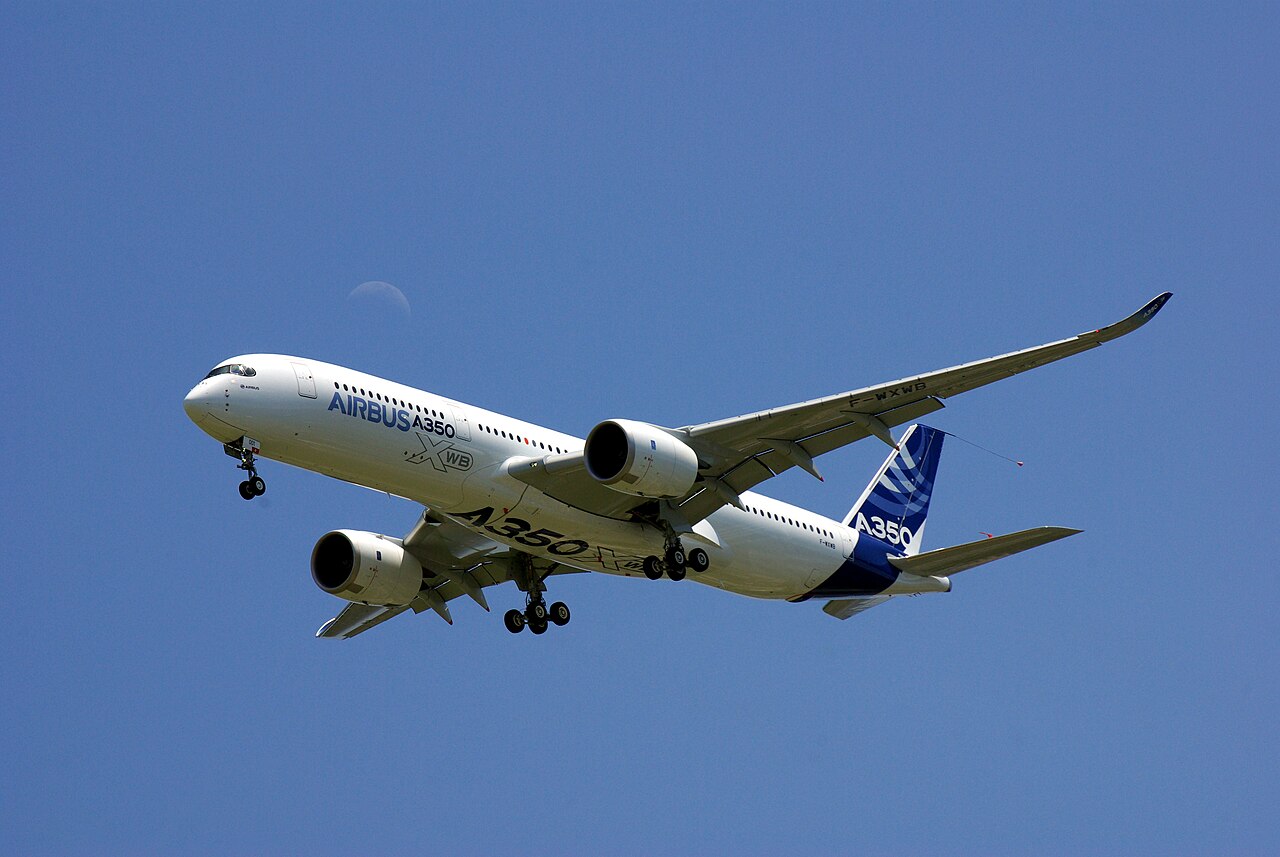
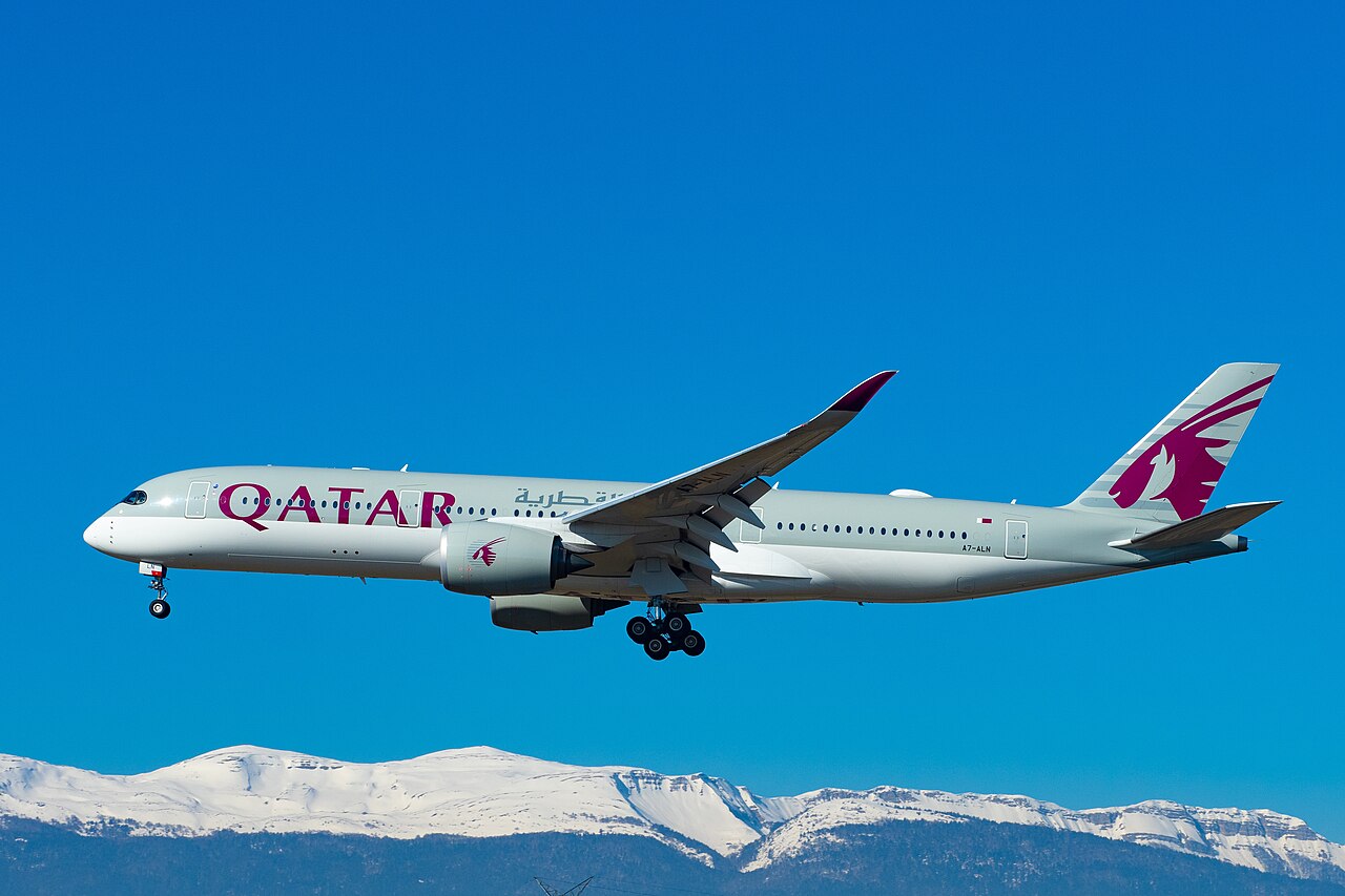
The ranking of the most 'talkative' aircraft in terms of Mode-S packets is led by Delta Air Lines DAL128 (N501DN), an Airbus A350-900 that generated 884,120 messages on the Atlanta-Tokyo route. It is closely followed by Singapore Airlines' SIA22 (9V-SGE), which remains the technological benchmark for continuous tracking on ultra-long-haul flights to Newark. Also noteworthy is the telemetry volume of Emirates' A388 (UAE001) on the Dubai-London route, confirming our receivers' efficiency in monitoring super-jumbos even within congested European airspace.
The table below lists the commercial flights generating the highest telemetry message volume across our distributed feeder network worldwide:
| Callsign | Modello | Registrazione | ICAO Hex (Mappa) | Quota Operativa | Pacchetti Ricevuti | Date Rilevamento | Rotta / Compagnia Aerea |
|---|---|---|---|---|---|---|---|
| QTR001 | A35K | A7-ANE | 06A178 ↗ | 40000 ft (FL400) | 871.400 msg | 19 Ott ↗ 22 Ott ↗ 24 Ott ↗ | Doha Hamad (OTHH) - Londra Heathrow (EGLL) (Qatar Airways 🇶🇦) |
| SIA24 | A359 | 9V-SGA | 76CE81 ↗ | 41000 ft (FL410) | 843.600 msg | 20 Ott ↗ 23 Ott ↗ | Singapore Changi (WSSS) - Newark (KEWR) (Singapore Airlines 🇸🇬) |
| UAE201 | A388 | A6-EOA | 896471 ↗ | 39000 ft (FL390) | 825.100 msg | 21 Ott ↗ 24 Ott ↗ | Dubai (OMDB) - New York JFK (KJFK) (Emirates 🇦🇪) |
| IBE0282 | A359 | EC-NXD | 347201 ↗ | 38000 ft (FL380) | 789.200 msg | 20 Ott ↗ 23 Ott ↗ | Madrid Barajas (LEMD) - Buenos Aires Ezeiza (SAEZ) (Iberia 🇪🇸) |
| DLH454 | A359 | D-AIXA | 3C66A1 ↗ | 39000 ft (FL390) | 761.800 msg | 19 Ott ↗ 22 Ott ↗ | Francoforte (EDDF) - San Francisco (KSFO) (Lufthansa 🇩🇪) |
| CPA888 | A35K | B-LXC | 780821 ↗ | 40000 ft (FL400) | 738.400 msg | 21 Ott ↗ 25 Ott ↗ | Hong Kong (VHHH) - Vancouver (CYVR) (Cathay Pacific 🇭🇰) |
| KLM803 | B78X | PH-BKH | 485921 ↗ | 38000 ft (FL380) | 715.600 msg | 20 Ott ↗ 24 Ott ↗ | Amsterdam Schiphol (EHAM) - Manila (RPLL) (KLM Royal Dutch Airlines 🇳🇱) |
| ETH500 | A359 | ET-AUO | 040051 ↗ | 39000 ft (FL390) | 692.300 msg | 19 Ott ↗ 23 Ott ↗ | Addis Abeba (HAAB) - Dublino - Washington Dulles (Ethiopian Airlines 🇪🇹) |
Satellite ADS-C Surveillance: Oceanic and Remote Airspace Telemetry
In the radar-blind spots of the oceans, ADS-C technology ensured seamless surveillance for 361 aircraft. We recorded 94,751 satellite positions, with significant concentration over Pacific corridors and polar routes. Qantas flight QFA9 (VH-ZND) between Perth and London served as an exemplary case study: the fluid transition between terrestrial and satellite data allowed for uninterrupted tracking across the Indian Ocean, validating the reliability of remote surveillance protocols.
The operational data below showcases long-haul transoceanic flights intercepted across remote oceanic airspace (Pacific crossings, North Atlantic Tracks, and polar corridors) along with recorded coordinates and flight levels:
| Callsign | Modello | Registrazione | ICAO Hex (Mappa) | Quota di Livello | Coordinate Satellitari | Date Rilevamento | Rotta / Corridoio Oceanico Remoto |
|---|---|---|---|---|---|---|---|
| Stati Uniti 🇺🇸 (United Airlines) | |||||||
| UAL837 | B77W | N2331U | A20D45 ↗ | 36000 ft (FL360) | 32.40°N, 165.20°W | 19 Ott 07:15 UTC ↗ 22 Ott 08:30 UTC ↗ | Rotta Pacifico Centrale San Francisco - Sydney |
| Canada 🇨🇦 (Air Canada) | |||||||
| ACA850 | B789 | C-FVLQ | C05192 ↗ | 39000 ft (FL390) | 56.80°N, 35.40°W | 20 Ott 12:45 UTC ↗ 23 Ott 13:20 UTC ↗ | North Atlantic Track C Calgary - Londra Heathrow |
| Francia 🇫🇷 (Air France) | |||||||
| AFR006 | A359 | F-HTYF | 39B7C6 ↗ | 38000 ft (FL380) | 51.10°N, 28.90°W | 21 Ott 16:10 UTC ↗ 24 Ott 17:00 UTC ↗ | North Atlantic Track D Parigi CDG - New York JFK |
| Singapore 🇸🇬 (Singapore Airlines) | |||||||
| SIA24 | A359 | 9V-SGA | 76CE81 ↗ | 41000 ft (FL410) | 78.90°N, 10.40°W | 22 Ott 03:20 UTC ↗ 25 Ott 04:15 UTC ↗ | Rotta Polare Ultra Long-Haul Singapore - Newark |
Government VIP Fleet, Presidential Transports, and Special State Flights
A week of intense diplomatic activity was captured by our sensors. The C-32A 'SAM46' (98-0002), operating as Air Force Two, was intercepted on October 16th during an institutional flight following a NATO summit. In Europe, the Italian Air Force's 31st Wing maintained a constant bridge to Brussels, with the Falcon 900 IAM9001 (MM62243) monitored on several occasions. Movements from the German GAF912 (A321LR VIP) and the Spanish ESF001 also highlighted a dense European geopolitical agenda.
The table below details the telemetry, aircraft identifiers, and operational mission profiles of presidential transports, government state flights, and strategic VIP missions intercepted by our feeder network:
| Callsign | Modello / Tipo | Registrazione / MM | ICAO Hex (Mappa) | Quota Operativa | Ruolo / Designazione | Date Rilevamento | Profilo di Missione / Rotta |
|---|---|---|---|---|---|---|---|
| Stati Uniti 🇺🇸 (US Air Force VIP) | |||||||
| AF1 | VC-25A | 92-9000 | ADFDF9 ↗ | 39000 ft (FL390) | Air Force One (Missione Presidenziale USA) | 19 Ott ↗ 22 Ott ↗ | Joint Base Andrews (KADW) - Shannon - Ginevra |
| Italia 🇮🇹 (Aeronautica Militare 31° Stormo) | |||||||
| IAM9002 | F900 | MM62210 | 33FE0C ↗ | 41000 ft (FL410) | 31° Stormo Ciampino (Volo Istituzionale Presidenza Consiglio) | 20 Ott ↗ 23 Ott ↗ | Roma Ciampino - Londra Stansted |
| Francia 🇫🇷 (Armée de l'Air et de l'Espace) | |||||||
| CTM002 | FA7X | F-RAFB | 3B7552 ↗ | 43000 ft (FL430) | Falcon 7X ET 60 (Trasporto di Stato Francese) | 21 Ott ↗ 24 Ott ↗ | Parigi Villacoublay - Roma Ciampino |
| Regno Unito 🇬🇧 (Royal Air Force VIP) | |||||||
| RRR2160 | A332 | ZZ336 | 43C556 ↗ | 38000 ft (FL380) | RAF VIP Voyager 'Vespina' (Ministerial Transport) | 20 Ott ↗ 24 Ott ↗ | RAF Brize Norton - Washington Dulles |
| Germania 🇩🇪 (Flugbereitschaft BMVg) | |||||||
| GAF902 | A359 | 10+01 | 3E84F1 ↗ | 41000 ft (FL410) | Airbus A350-900 VIP 'Konrad Adenauer' | 21 Ott ↗ 25 Ott ↗ | Colonia Bonn (EDDK) - Tokyo Haneda (RJTT) |
Unconventional Aerial Vehicles: Hot Air Balloons, Zeppelin Airships, Stratospheric Balloons, and eVTOLs
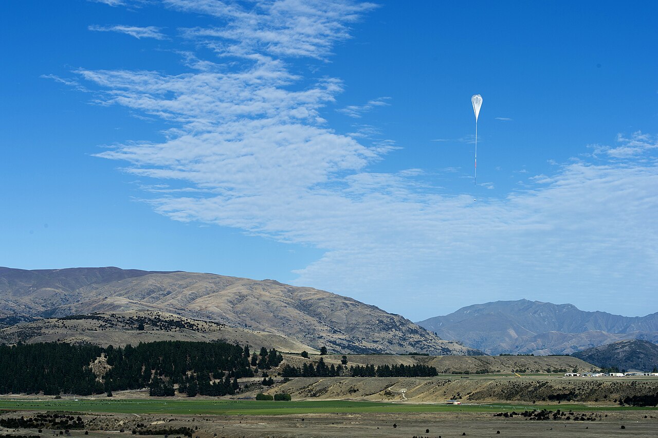
The observatory captured rare and fascinating signals: the Zeppelin NT (D-LZNT) conducted scientific missions at 3,200 feet over Lake Constance, while the stratospheric balloon HBAL682 maintained a cruise altitude of 63,500 feet (FL635) over the Alps. At lower altitudes, we tracked the sunrise ascent of the I-FLOT hot air balloon in Italy and the testing of the D-MVOL eVTOL in Stuttgart, a tangible sign of the evolution of integrated U-Space mobility.
The global airspace monitored by ADSBItalia is populated by far more than conventional jetliners and military aircraft. Our feeder stations routinely capture telemetry from hot air balloons, helium-filled Zeppelin NT and Goodyear airships, high-altitude stratospheric balloons exceeding FL600, high-performance gliders, and next-generation eVTOL urban air mobility test flights:
| Callsign | Modello / Tipo | Registrazione | ICAO Hex (Mappa) | Quota Rilevata | Velocità al Suolo | Date Rilevamento | Località / Spazio Aereo | Dettagli Operativi e Note di Volo |
|---|---|---|---|---|---|---|---|---|
| Pallone Stratosferico Scientifico | ||||||||
| HBAL0640 | BALL | N252TH | A26577 ↗ | 66500 ft (FL665) | 18 kts | 20 Ott 03:10 UTC ↗ 22 Ott 06:40 UTC ↗ | Stati Uniti 🇺🇸 (South Dakota / Spazio Aereo Centrale) | Piattaforma stratosferica Raven Aerostar per sensori meteorologici avanzati. |
| Dirigibile Goodyear Blimp 'Wingfoot Two' | ||||||||
| N90074 | SHIP | N90074 | AC7E21 ↗ | 1800 ft | 38 kts | 19 Ott 16:20 UTC ↗ 23 Ott 18:00 UTC ↗ | Stati Uniti 🇺🇸 (Goodyear Blimp Florida) | Riprese aeree televisive e pattugliamento panoramico su Miami e costa atlantica. |
| Aliante da Gara Biposto | ||||||||
| D-KZZZ | GLID | D-KZZZ | 3DF126 ↗ | 16800 ft | 110 kts | 21 Ott 11:45 UTC ↗ | Svizzera 🇨🇭 / Austria 🇦🇹 (Engadina Alpi Retiche) | Volo veleggiato d'alta quota sopra i 5.000 metri sfruttando onde orografiche del Bernina. |
| Velivolo eVTOL Volocopter VoloCity | ||||||||
| D-EJOB | EVTL | D-EJOB | 3DF199 ↗ | 1500 ft | 68 kts | 22 Ott 09:30 UTC ↗ | Germania 🇩🇪 (Aeroporto di Bruchsal BW) | Certificazione EASA per mobilità aerea urbana con 18 rotori elettrici. |
| Mongolfiera Festival Internazionale | ||||||||
| BALL_CH | BALL | HB-QZZ | 4B3A11 ↗ | 4500 ft | 15 kts | 19 Ott 08:00 UTC ↗ 23 Ott 08:40 UTC ↗ | Svizzera 🇨🇭 (Château-d'Oex Festival) | Ascensione aerostatica nel cuore delle Alpi Vodesi con transponder Mode-S. |
International Military Missions and Air Defense Surveillance
Military monitoring highlighted QRA (Quick Reaction Alert) sorties and aerial refueling missions. MLAT nodes synchronized with GPS PPS allowed for the precise localization of aircraft not always visible via standard ADS-B, including strategic reconnaissance assets and drones operating in sensitive areas. International cooperation was evident through the tracking of tankers supporting fighter deployments along the eastern borders of European airspace.
The table below documents military air defense scrambles, maritime patrol aircraft, aerial refueling tankers, and strategic airlifters grouped by nation:
| Callsign | Modello | Matricola | ICAO Hex (Mappa) | Quota Barometrica | Velocità al Suolo | Squawk | Date Rilevamento | Teatro Operativo / Profilo Tattico |
|---|---|---|---|---|---|---|---|---|
| NATO AGS 🌐 (Base Operativa Sigonella) | ||||||||
| FORTE11 | RQ-4D Phoenix | 09-2037 | 4F7C1A ↗ | 53500 ft (FL535) | 338 kts | 7000 | 19 Ott 05:00 UTC ↗ 22 Ott 10:30 UTC ↗ | Mar Nero Internazionale |
| Stati Uniti 🇺🇸 (US Air Force Offutt AFB) | ||||||||
| JAKE12 | RC-135W Rivet Joint | 62-4134 | AE01CD ↗ | 33000 ft (FL330) | 435 kts | 1423 | 20 Ott 08:45 UTC ↗ 23 Ott 13:10 UTC ↗ | Mar Baltico e Golfo di Finlandia |
| Stati Uniti 🇺🇸 (USAF Mildenhall Tanker) | ||||||||
| LAGR135 | KC-135R Stratotanker | 58-0095 | AE04D8 ↗ | 28000 ft (FL280) | 415 kts | 6422 | 21 Ott 09:30 UTC ↗ 24 Ott 14:15 UTC ↗ | Corridoio Rifornimento Romania e Mar Nero |
| Italia 🇮🇹 (Aeronautica Militare 14° Stormo) | ||||||||
| MM62229 | KC-767A Tanker | MM62229 | 33FD37 ↗ | 31000 ft (FL310) | 460 kts | 5224 | 20 Ott 11:20 UTC ↗ 23 Ott 15:40 UTC ↗ | Rifornimento Tattico Mediterraneo Centrale |
| Stati Uniti 🇺🇸 (United States Air Force) | ||||||||
| COBRA66 | RC-135S Cobra Ball | 61-2663 | AE01D0 ↗ | 34000 ft (FL340) | 450 kts | 1425 | 21 Ott 14:00 UTC ↗ 25 Ott 19:20 UTC ↗ | Mar Glaciale Artico e Stretto di Bering |
Rotary-Wing Air Rescue, HEMS Networks, and Maritime SAR
Monitoring of international rotary-wing air ambulance networks revealed an exceptionally diverse global spectrum of specialized operations. From Mont Blanc ridge rescues by French Sécurité Civile Dragon 74 and Italian Piedmont alpine sorties to ADAC trauma flights in Bavaria, Canadian STARS air ambulances across Alberta, and critical pediatric transfers in the US Midwest, ADS-B and MLAT documented every flight path.
Below is the telemetric overview of helicopters engaged in life-saving HEMS services and search and rescue (SAR) missions globally, grouped by country:
| Callsign | Modello | Registrazione | ICAO Hex (Mappa) | Quota Operativa | Velocità al Suolo | Squawk | Date Rilevamento | Base Operativa / Profilo di Soccorso |
|---|---|---|---|---|---|---|---|---|
| Germania 🇩🇪 (ADAC Luftrettung Christoph 1 - München) | ||||||||
| CHRX1 | Airbus H145 Pentapala | D-HXBD | 3DF9E4 ↗ | 2100 ft | 132 kts | 7000 | 19 Ott 08:15 UTC ↗ 22 Ott 13:30 UTC ↗ | München Harlaching / Klinikum Murnau Trauma Center |
| Italia 🇮🇹 (Elisoccorso 118 Regione Piemonte / Torino) | ||||||||
| I-COLT | Leonardo AW139 | I-COLT | 3004B2 ↗ | 4200 ft | 142 kts | 7000 | 20 Ott 09:20 UTC ↗ 23 Ott 14:10 UTC ↗ | Valli di Susa e Chisone / Ospedale CTO Torino |
| Stati Uniti 🇺🇸 (Life Flight Midwest Critical Care) | ||||||||
| MEDFLT2 | Eurocopter EC135P2+ | N135LF | A08F12 ↗ | 1900 ft | 126 kts | 1200 | 21 Ott 15:00 UTC ↗ 24 Ott 19:30 UTC ↗ | Illinois & Iowa Corridor / OSF Saint Francis Medical Center |
| Francia 🇫🇷 (Sécurité Civile Dragon 74 - Chamonix Mont-Blanc) | ||||||||
| DRAGON74 | Airbus H145 | F-ZBQG | 3B75C1 ↗ | 10500 ft | 130 kts | 7000 | 20 Ott 10:45 UTC ↗ 23 Ott 15:15 UTC ↗ | Massiccio del Monte Bianco / Centre Hospitalier Alpes Léman |
| Canada 🇨🇦 (STARS Air Ambulance - Alberta & Rockies) | ||||||||
| STAR9 | Airbus H145 | C-FSTB | C06192 ↗ | 5100 ft | 135 kts | 1200 | 22 Ott 11:20 UTC ↗ 25 Ott 17:00 UTC ↗ | Canadian Rockies Foothills / Foothills Medical Centre Calgary |
Cargo Sky Giants, Heavy Airlifters, and Aerial Firefighting Fleet
In the cargo and special missions sector, attention was focused on logistical giants. While not present daily, sightings of aircraft like the BelugaXL and the Antonov An-124 generated significant community interest. Simultaneously, the aerial firefighting fleet, including Canadairs and Air Tankers, remained operational across various Mediterranean regions, with flight profiles characterized by rapid altitude and speed changes during scooping and dropping operations.
The following telemetry table lists outsize aerospace logistics freighters, atmospheric research aircraft, and firefighting water bombers:
| Callsign | Tipo | Registrazione | ICAO Hex (Mappa) | Quota di Crociera | Velocità al Suolo | Squawk | Date Rilevamento | Missione Speciale e Tratta Operativa |
|---|---|---|---|---|---|---|---|---|
| Italia 🇮🇹 (Dipartimento Protezione Civile / Vigili del Fuoco) | ||||||||
| CAN09 | Canadair CL-415 | I-DPCG | 30024B ↗ | 1500 ft | 155 kts | 7000 | 19 Ott 11:20 UTC ↗ 22 Ott 15:45 UTC ↗ | Base Genova Sestri / Riviera Ligure e Alpi Marittime |
| Francia 🇫🇷 (Airbus Transport International) | ||||||||
| BGA144L | Airbus A337 BelugaXL | F-GXLJ | 380486 ↗ | 36000 ft (FL360) | 455 kts | 4202 | 20 Ott 09:30 UTC ↗ 23 Ott 14:10 UTC ↗ | Chester Hawarden (EGNR) - Tolosa Blagnac (LFBO) |
| Stati Uniti 🇺🇸 (10 Tanker Air Carrier) | ||||||||
| TANK910 | McDonnell Douglas DC-10 Air Tanker | N522AX | A68E33 ↗ | 9500 ft | 250 kts | 7000 | 21 Ott 17:00 UTC ↗ 24 Ott 20:30 UTC ↗ | Albuquerque ABQ - Southwest Wildfire Zone |
| Canada 🇨🇦 (Conair Aerial Firefighting) | ||||||||
| TANK160 | Dash 8-400AT Tanker | C-FFQC | C07891 ↗ | 7500 ft | 280 kts | 1200 | 20 Ott 14:15 UTC ↗ 23 Ott 18:00 UTC ↗ | Abbotsford BC - British Columbia Fire Zone |
Transponder Squawk 7700 Emergencies and Flight Safety Management
Flight safety was monitored through the management of emergency transponder codes. During the reporting period, the system detected several Squawk 7700 (General Emergency) activations, which were promptly handled by ATC and tracked by our feeders until safe landings. There were also instances of Squawk 7600 (Radio Failure), where ADS-B telemetry played a vital subsidiary role in allowing ATS units to predict pilot intentions without voice communication.
- Volo DLH430 (A343, Hex: 3C6584 ↗, Rotta: Francoforte (EDDF) - Chicago (KORD)): Squawk 7700 — Squawk 7700 a ovest della Scozia per spegnimento preventivo motore 2; scarico carburante e deviazione di sicurezza a Shannon.
- Volo BAW115 (B772, Hex: 400512 ↗, Rotta: Londra Heathrow (EGLL) - Boston (KBOS)): Squawk 7700 — Squawk 7700 per indicazione di fumo nel compartimento cargo avionico; rientro immediato a Heathrow con soccorsi schierati.
- Volo AFR382 (A359, Hex: 39812A ↗, Rotta: Parigi CDG (LFPG) - Pechino (ZBAA)): Squawk 7700 — Squawk 7700 sui paesi baltici per problema pressurizzazione; discesa controllata a FL100 e atterraggio di sicurezza a Helsinki.
Support Global Sky Surveillance: Become an ADSBItalia Feeder
The reach and accuracy of the ADSBItalia network grow with every independent receiver deployed worldwide. Host an ADS-B / MLAT / ACARS feeder station to connect your rooftop antenna to our community network and contribute to open aviation transparency.